
Lower Southampton Township ZIP Coverage
Three postal combinations appear when Bucks County's 202503 address-point layer is grouped for Lower Southampton Township. The postal community shown on a delivery address and the incorporated municipality are separate facts. This ZIP code directory therefore treats 19053 as the dominant postal footprint, while 19006 and 18966 are narrow Township edge or splice areas. The figures below are county GIS address-point records, not a count of residents, occupied homes, or individual delivery customers.
| ZIP | Areas covered | Post office | Notes |
|---|---|---|---|
| 19053 | Feasterville Trevose; the dominant Township postal footprint | Feasterville Trevose Post Office, 275 E. Street Road, Suite A, Feasterville Trevose, PA 19053-9997 | 8,255 Lower Southampton address points. The same ZIP also has points in Bensalem, Northampton, and Middletown, so it is not municipal proof. |
| 19006 | Huntingdon Valley postal label; Township edge or splice portions | Huntingdon Valley Post Office, 830 Welsh Road, Huntingdon Valley, PA 19006-9998 | 121 Lower Southampton points. County-layer inference indicates this ZIP also reaches Upper Southampton. |
| 18966 | Southampton postal label; a small Township edge or splice portion | Southampton Post Office, 1050 Street Road, Southampton, PA 18966-9998 | 9 Lower Southampton points. County-layer inference indicates most points are in Northampton and Upper Southampton. |
No official source verified a Township-serving PO-box-only ZIP or a unique single-institution ZIP. Postal terms do not replace a municipal record. Note: Use an exact delivery address for a postal result rather than deriving a ZIP from the Township name.
Lower Southampton ZIP Counts
Numbers. The 202503 county GIS grouping produced 8,255 address points in 19053, 121 in 19006, and 9 in 18966 for the Lower Southampton Township municipal field. The uneven totals show why a ZIP search cannot be read as a Township-wide resident count. They describe mapped address points. A point can help validate an address spelling or postal label, but it does not establish occupancy, ownership, household size, or a person's current location.
Source: the Bucks County address-point service provides the county postal and municipality fields behind this analysis.
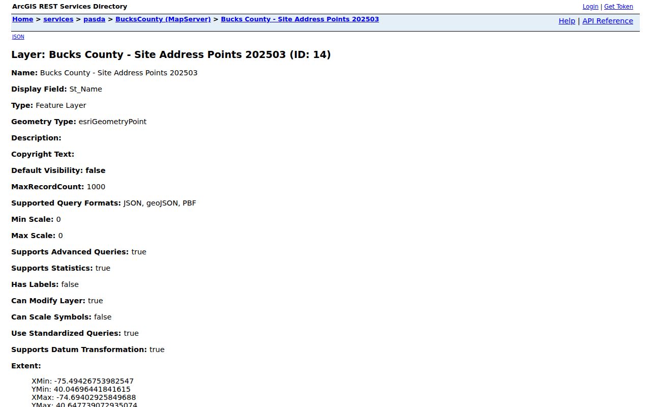
The service accepts REST queries without a login, including where clauses, selected output fields, geometry, sorting, grouping, and statistics. It can return HTML, JSON, or GeoJSON, with a maximum of 1,000 features per response. Grouping by the municipal field is the useful check where a postal label crosses a local boundary.
Lower Southampton USPS ZIP Checks
The USPS ZIP Code Lookup is the first step for a single delivery address and its ZIP+4. Enter the delivery address rather than only the Township name. USPS verifies mailing information for that address, while the county municipal and parcel records answer a different question about local jurisdiction and property. A postal lookup is the practical way to resolve a current delivery label before comparing county fields.
Source: the USPS address lookup is the official delivery-address and ZIP+4 route.
The lookup should be repeated when a house number, directional term, road suffix, or unit number changes. It verifies an individual delivery result, not the edge of a Township or a list of physical addresses within one postal area.
Source: the Feasterville Trevose Post Office details identify the facility associated with the dominant local postal footprint.
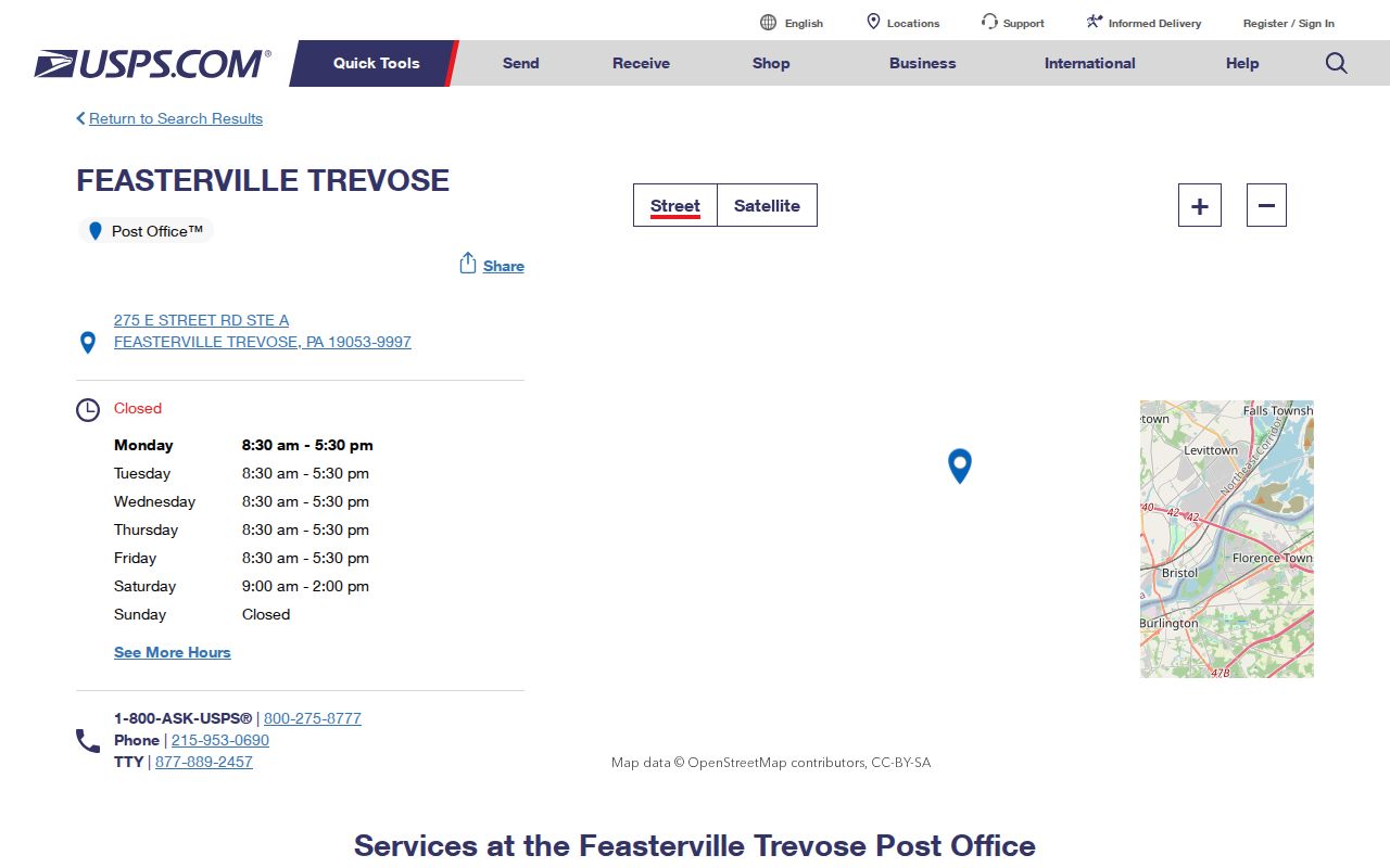
The facility information helps distinguish a post office location from the broader area using the 19053 mailing label. It does not mean every address bearing that label lies inside Lower Southampton Township.
Finding Lower Southampton ZIP Records
Use a postal result as an address check, then move to the source that answers the next question. The county property tools do not create a Township-wide occupant roll from a postal label. They can instead place a parcel in a municipality, tie it to a location address, and retain the parcel or legal description needed for a deed chain. This ZIP code directory keeps the postal step separate from property evidence for that reason.
- Check the complete delivery address in the USPS lookup and keep the resulting ZIP+4 if it is needed for mail verification.
- Search the Bucks County Tax Claim Public Access form with a location address, last name, or parcel number as appropriate.
- Select Lower Southampton in the municipality control where the property search needs a countywide result narrowed to the Township.
- Use the county parcel or address-point record to compare the location address, municipal field, and parcel identifier.
- Keep the legal description and parcel number for Recorder research if the address has an old road name or a crossed postal boundary.
Once the municipality and street are known, the Lower Southampton Township street address directory provides the address-by-address record route. Note: A ZIP filter can be useful for mailing data but does not define all parcels physically inside a postal area.
Lower Southampton ZIP Search Fields
Bucks County Tax Claim Public Access offers several search controls, but the Zip Code input sits within Owner Information with mailing address and city. It is not a physical-geography filter for every parcel inside a postal boundary. The form needs either a parcel number or a last name or address. Retain all dashes in a parcel number, and use a house number with street name only for a location-address search.
| Field label | Type | Required | Options or format |
|---|---|---|---|
| Parcel Number | Text | One of parcel number or last name/address required | Enter all dashes; the county publishes sample parcel formats. |
| Location Address | Text | Optional within a search | Use house number plus street name only. |
| School District | Dropdown | Optional | Dropdown options were not exposed by the captured page. |
| Municipality | Dropdown | Optional | Select Lower Southampton to narrow a countywide search; the captured page did not expose every option. |
| Name | Text | Optional within a search | Last name first: Smith, John or Smith John. |
| Mailing Address | Text | Optional | Owner-contact address; it may differ from the site address. |
| City | Text | Optional | Mailing-city field. |
| Zip Code | Text | Optional | Mailing ZIP field; it can filter owner mailing data rather than municipal geography. |
| Search / Reset | Buttons | Not applicable | Button behavior was not exposed by the text capture. |
The county parcel schema has an address and municipality but no ZIP field. Township MapLink is address or click-parcel based, not a ZIP browsing tool. That is why a delivery check, municipal filter, and parcel identifier work better together than one postal search.
Lower Southampton Postal Boundaries
Geography. ZIP 19053 crosses Lower Southampton Township, Bensalem, Northampton, and Middletown in the county layer. The Township portions of 19006 and 18966 are much smaller. The 19006 points are around Buck, County Line, Pike, and Veit roads, while the 18966 group is around Chinquapin Road and West Bristol Road. Those observations locate data points, not neighborhoods, occupancy, or people.
- ZIP versus ZIP+4
- A ZIP identifies a postal delivery area; ZIP+4 adds a more specific delivery segment for an individual address.
- PO-box ZIP
- A postal code assigned for post-office boxes rather than a general delivery area. None was verified here as Township-serving.
- Unique ZIP
- A postal code assigned to one institution or organization. None was verified here for the Township.
- Carrier route
- A postal delivery sequence. It is not a municipal boundary or a roster of people.
For a municipal comparison, use the county layer's Inc_Muni field rather than a postal community name. The field is the direct local check when a ZIP label extends beyond Township limits.
Lower Southampton Mailing-ZIP Myth
Myth. A parcel owner's mailing address, city, or ZIP does not identify who physically lives at the parcel. The Tax Claim form keeps location address and mailing-address inputs separate because they serve different records purposes. A mailing location may be outside the Township, outside the site ZIP, or simply a correspondence address. It should not be treated as a comprehensive household list.
The county parcel service similarly exposes owner-related fields and parcel values but not a household roster, owner mailing address, deed image, or legal certainty of a boundary. When a question concerns parcel identity, the Recorder's legal description and recorded instruments are the stronger next record.
Lower Southampton ZIP Address History
Postal research can fail when an old document uses a road name that was later changed. The Township's street-name appendix records 1957 changes from Orchard to Acorn, Brookside to Russet, Clearview to Valley, Hilltop to Colonial, Maple to School, Park to Second, Summit to Meadowbrook, William to Revere, and Woodland to Riverview. Fox Hollow became Sweetwater in 1991, and Skyline Avenue became Skyline Drive in 1993.
The Township Code's house-numbering section authorizes the numbering plan and street-name changes. Its street-name history appendix supplies the recorded crosswalk. Try old and current road names, then bridge the result with a legal description or parcel number. A road-name update alone does not prove that every house number stayed the same.
Earlier work also needs Southampton, Feasterville, Trevose, Oakford, Siles, Brownsville, or Scottsville as possible index language. Township history records the Upper and Lower Southampton division in 1928, so a pre-1928 postal or directory label needs a date and municipal check.
Lower Southampton ZIP Address Fields
The county address-point and road-centerline services give a documented way to compare postal and municipal data. They are reference layers, not proof of current occupants. The address-point REST service exposes full address, postal, municipal, parcel, and coordinate data. The road layer adds the ranges and left or right postal fields needed to understand a road segment where delivery information changes.
Full_Addr | Full E911-style site address point for checking an address spelling. |
|---|---|
Post_Code and Post_Comm | Postal ZIP and postal community label, without substituting either for municipality. |
Inc_Muni | Incorporated or municipal jurisdiction field, including Lower Southampton Township selection. |
| Parcel ID | Identifier that bridges the E911 or road data to parcel and deed systems. |
| Coordinates | Location values associated with the address point. |
| From/to ranges and parity | Road-centerline ranges and side-of-road numbering context; not ownership proof. |
PostCode_L/R and PostComm_L/R | Postal code and community values on each road side, useful for a boundary check. |
Query controls support where, outFields, geometry, sorting, grouping, and statistics. Keep the address, municipal field, parcel ID, and relevant road-side values together when a ZIP code conflicts with the Township label. Note: The property and Recorder systems, not a map point, establish the parcel and recorded-document trail.